
New Mexico has mountains!?
When discussing New Mexico, it is almost shocking how often people are surprised that there are mountains there.Not only does New Mexico have mountains, but like #Colorado, it hosts three major mountain chains with several significant subranges:Rocky MountainsIntermountain WestGreat Plains
It is an amazing, unique natural landscape where alpine meets desert, cacti meet plains, and the mountains are as diverse and beautiful as anywhere. Tumbleweed Maps
Steve dsiscussed this doscpnnect thhat th ereast of the world has about New Mexico in Querencia. Other similar info below. Same source.
Open in new tabs to embiggen.
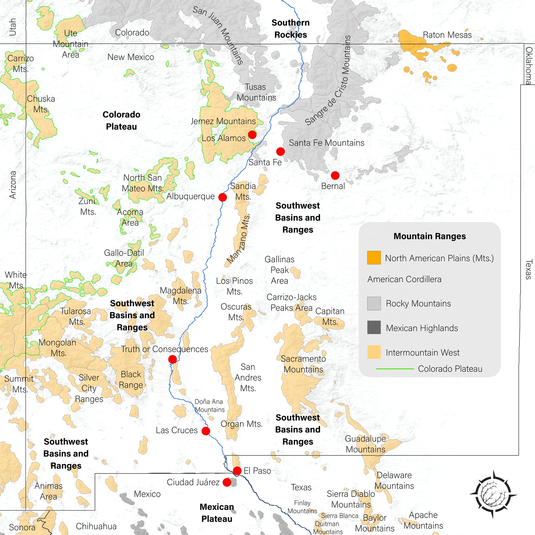
Where is the Southern Terminus of the Rocky Mountains?
There is no universally accepted definition of where the Rockies end, the intention of this post is meant to be more exploratory than definitive. With that said, this map uses the definitions of the GMBA Mountain Inventory.Many sources define the Sangre de Cristo Mountains as the southernmost portion of the Rockies.Culturally, it seems the Sandia and Manzano Mountains are strongly linked to being part of the Rockies. Then varying claims of the ranges continuing south through New Mexico, Texas, and even into Mexico. Examples would be the Organ and Sacramento Mountains.All these mountains are part of the larger American Cordillera, which extends from Alaska to South America.What matters for defining the Rockies? Is it strictly geology? Culture? History? Something else?
*Names, borders, and hierarchies are derived from the GMBA Mountain Inventory and EarthEnv dataset.
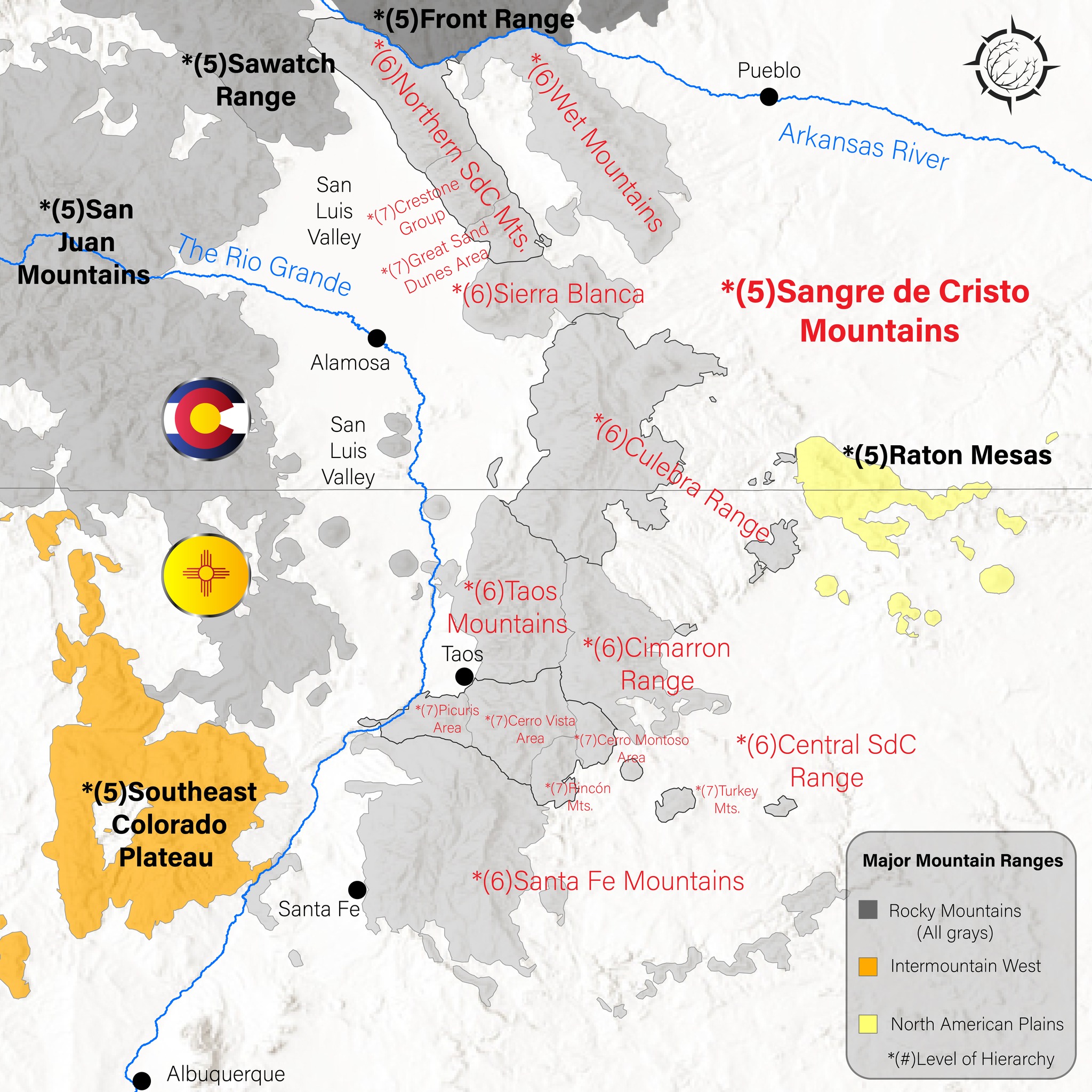
Hierarchy of the Sangre de Cristo Mountains
The Sangre’s are a mountain range in southern Colorado and northern New Mexico.It contains several subranges, notably the Wet Mountains, Crestones, Taos Mountains, and Santa Fe Mountains, among others.The southern portion of the Sangre de Cristo Mountains is the Santa Fe Mountains with the city of Santa Fe on the western edge. This is considered to be the southern terminus of the Rocky Mountains, but there is much debate on that point.
*Names, hierarchies, and boundaries are derived from the GMBA Mountain Inventory and EarthEnv dataset.