Many of us here are Corbett fans as are many around the world. It is no surprise that some have tried to follow Corbett’s footsteps and hunts. How accurate they are 100 years later I don’t know. Given the eco destruction since then I don’t doubt it looks a lot different now. More investigations of Corbett’s hunts are on the authors FB page. It looks like he put some effort into it. See also Corbett FB page.
A photo essay below.
CORBETT : THE WALK TO TALLA DES – SECTION C.
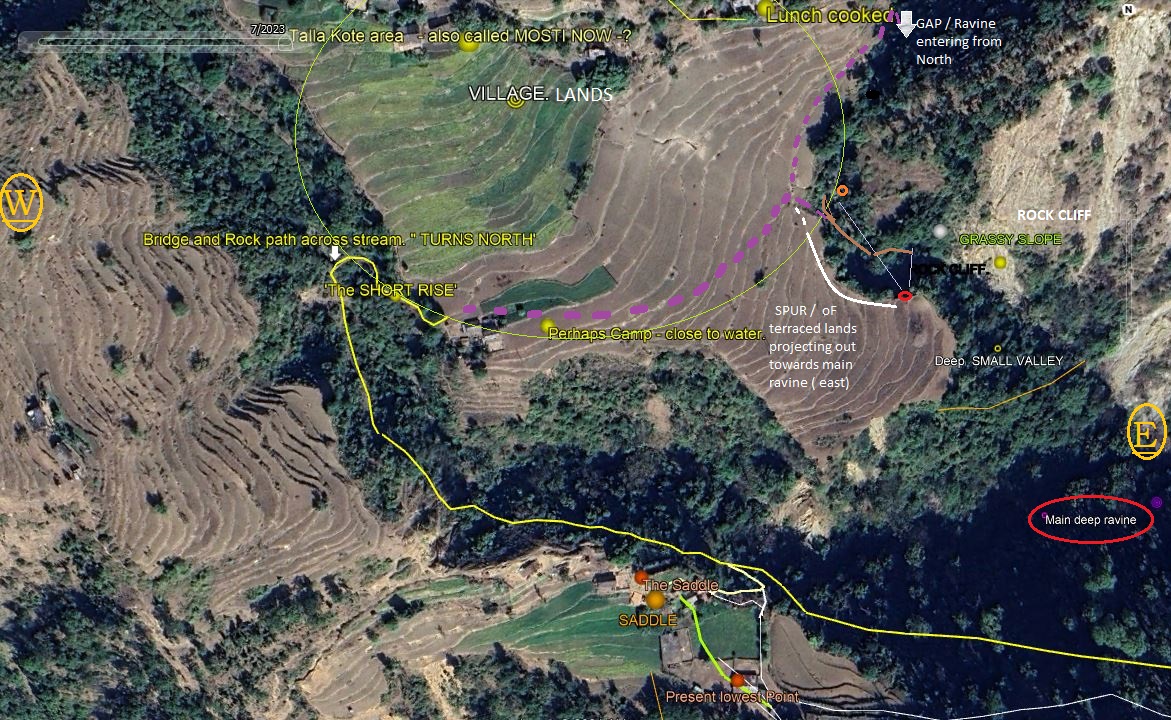
Having descended the 250 odd yards into the ravine, ( the head of the valley ), the forest road having recommenced on the north face of the ridge, having been cut into its steep southern side, where it began to rise again, having crossed its break after close to four miles.“ After going some four miles due west the forest road turned to the north and crossed the head of the valley. Flowing down the valley was a crystal clear stream which had its birth in the dense oak forest on the hill that towered above me on my left.”Here as Corbett notes in his quote above, the forest road turns north and crosses a stream coming in from the west on the left. Standing here one sees the ravine which has narrowed greatly is approximately forty feet wide, and continues on appearing to narrow further and turn in a north westerly direction towards the hills which now tower above on the left.The stream in this day, can be still crossed on stepping stones if one wishes, or can take the concrete slab which bridges the gap of about 12 feet across the stream, which is eight to ten feet below the slab of concrete.Crossing the stream a six foot wide path cut into the north side ( south face ) of the ravines steep side, rises for a short distance of about sixty to seventy yards, to exit the ravine and access the flat open terraced fields which come into view immediately when the top reaches eye level.Seen, on the far side, after stepping out of the ravine and onto the gently sloping terraced lands of the village, which seem to be in an excess of thirty odd acres, are a few scattered old homes mostly at the base of the steep tall hill to the north, at whose base are these terraced fields.This area now goes by the name Mosti ( not Mosta). These are the lands, some of which are still owned by the inhabitants of Tulla Kote, who we were given to understand came down each year from Tulla Kote, during the winter months to cultivate, graze their cattle and live here, sheltered on the southern face of this hill, until spring each year. ( refer to short interviews – my post, dated 4 May 2024 ( Talla des Revisited).“ I came out on an open stretch of ground on the far side of which was a village. Some girls coming down from the village on the way to the stream caught sight of me as I came out on the open ground, and they called out in great excitement, ‘ The Sahib has come! The Sahib has come!’ The cry was caught up from house to house and before I reached the village I was surrounded by a throng of men, women, and children.From the headman I learnt the name of the village was Talla Kote “.These terraced lands before you stretch out to the west and east with the stream and head of the ravine forming their southern boundary and the hill towering above the lands to its north.Looking east over the terraced lands they drop gently to their east, at the foot of the hill against which the village shelters, is seen a gap in the hill through which another ravine emerges, coming in from the north. This appears to drain the valley behind the hill causing it to empty into the main ravine forming the great valley going east to the river Kali.This causes the terraced land mass to project out towards the main ravine ( great valley) going east in the form of a spur or tongue, having the main ravine on its right and the ravine emerging from the north, from within the gap on its left.This section is of great importance for the role it plays in the whole hunt.Having gone east over the terraced lands and facing the gap, we see emerging as a narrow deep watercourse following the contour of the hill, this ravine / watercourse now on its right ( west) has the village terraced lands, and on its left a towering very steep hillside with a rocky cliff facing south, which curves left to the east, but briefly, for a very short distance curves to its right to form the mouth of a valley, which Corbett refers to as the ‘small valley’ . This valley from where its exits from the gap to where it joins the main ravine is approximately three hundred yards.One must note this entire terraced area and the small valley is cut off from the saddle and the forest road going east to Sem by the deep ravine in between. To access that area one must go through the village lands, down the ‘short rise Corbett came up on, cross the stream, ascend the ravine on its southern side via the forest road and take an offshoot path further up, to access the saddle.Hence the repeated use of “ through the village’ Corbett mentions each time the saddle is o be accessed.“I asked where the kill had taken place, a lad – – – — — if I would accompany him to the other side of the village he would point out to me – – – – -With the lad leading – – -we went through the village to a narrow saddle some fifty yards long connecting two hills “.
We shall stop here and follow Dungar Singh and Corbett to the saddle to confirm its orientation and return back to the small valley crossing the stream again and going through the village, in Section D to continue. Q.O 2024. Quinton Ottley
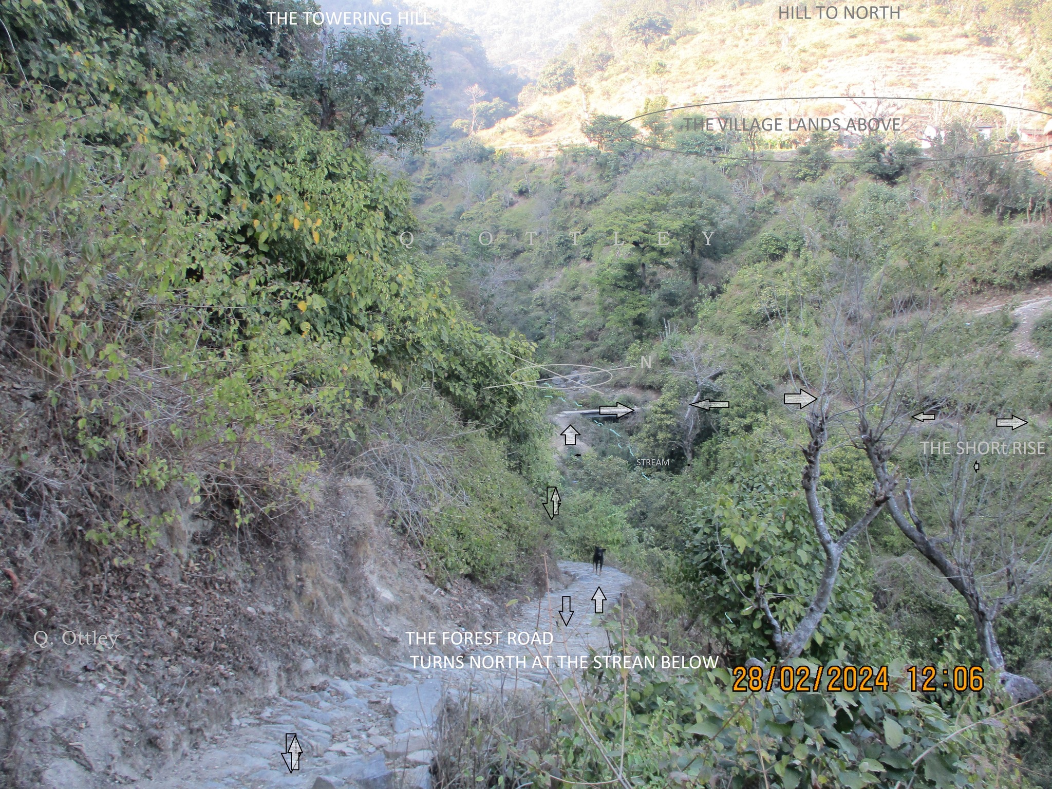
View of the forest road as it descends towards the stream below and turns north.
Seen is the present concrete slab for a bridge, and the path which rises for a short distance to the village lands above.
Seen is the present concrete slab for a bridge, and the path which rises for a short distance to the village lands above.
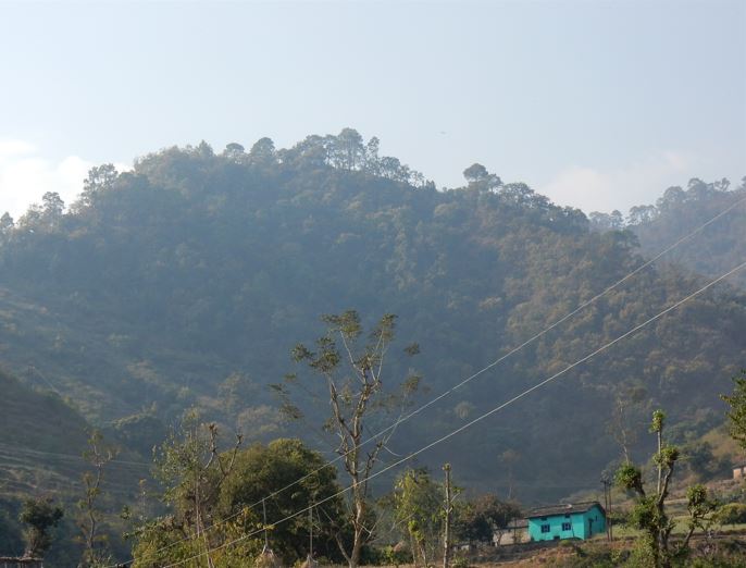
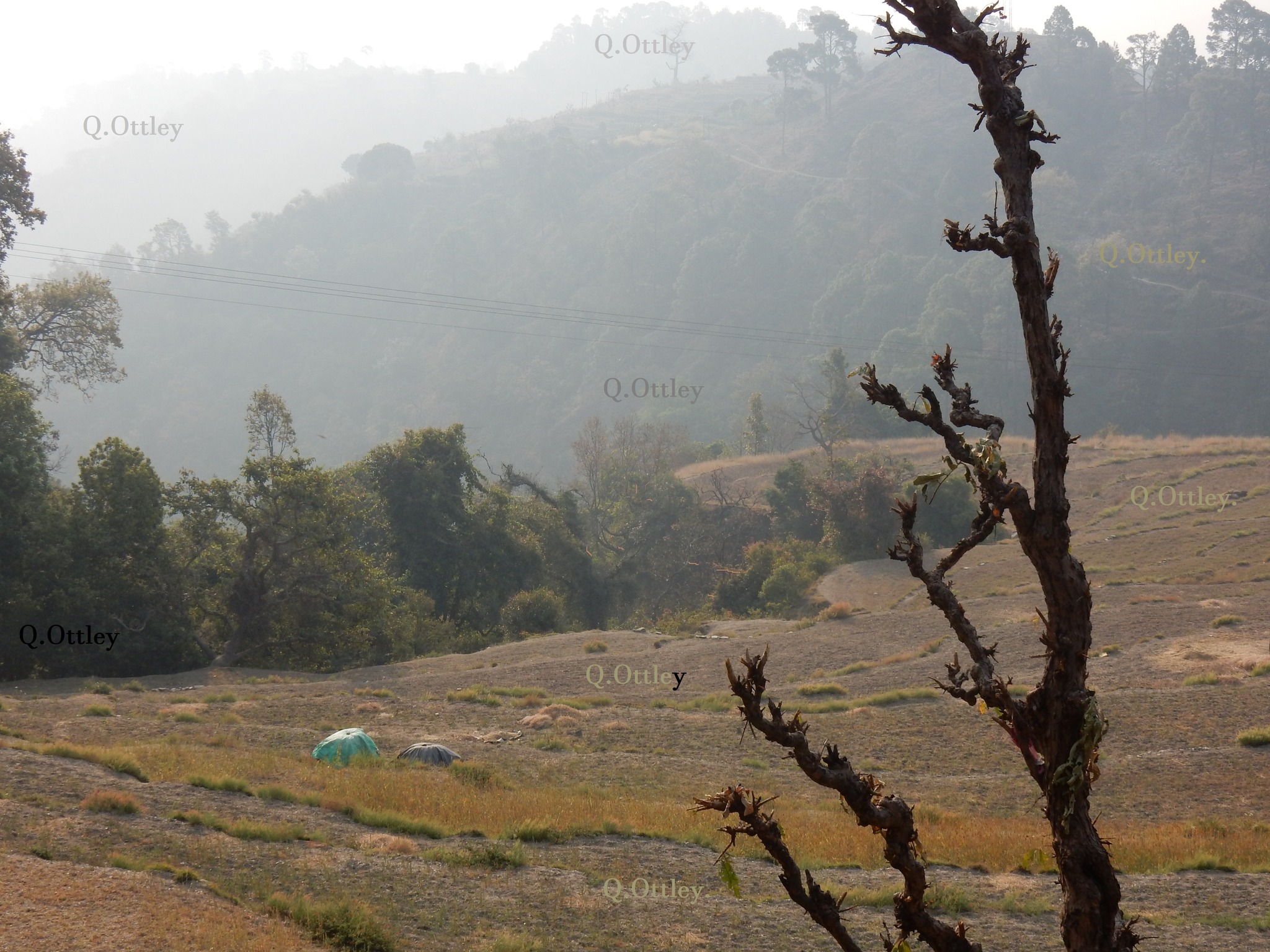
The hill to the west which towers above, when one stands at the stream way below and turns north over the stream.
Note, this image is taken from the forest road on the north face of the hill going to Sem.
It looks quite imposing when standing at the stream crossing way below.
Note, this image is taken from the forest road on the north face of the hill going to Sem.
It looks quite imposing when standing at the stream crossing way below.
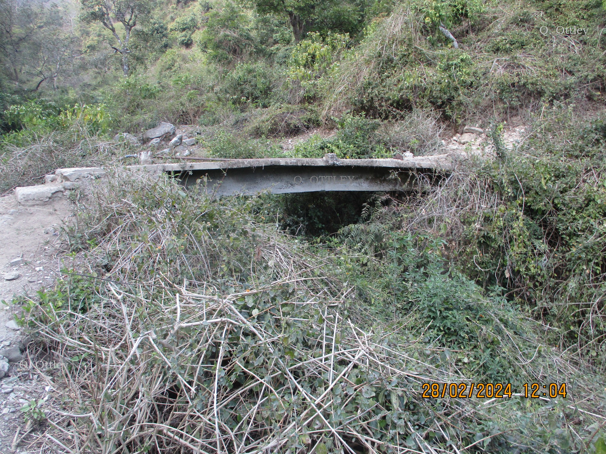
The concrete slab across the stream, when the path turns north to cross it.
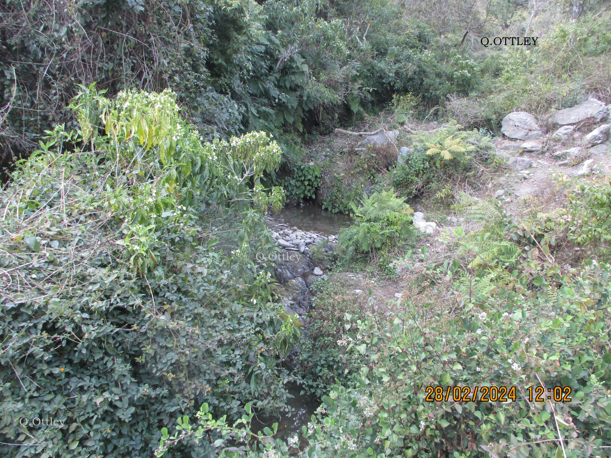
An image of the stream about eight to ten feet below the concrete bridge. A path still crosses the stream on the stepping stones.
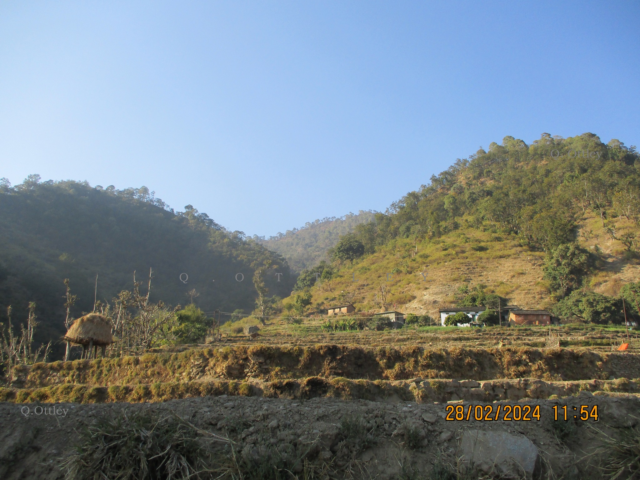
Emerging from the ravine’s north side, coming up the short rise, is seen the open terraced land and some houses against the foot of the hill to its north, on the far side of the village lands.
Imagery to help understand the lay out of the ground and why one has to go through the village lands, to access the saddle side on the other side.
View of the dense small valley, the village’s terraced lands and the spur projecting out towards the main valley to the east.