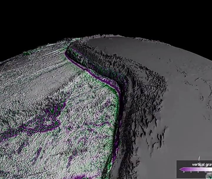
So NASA just dropped their most detailed map of the seafloor ever. We know so little about the ocean floor that this is. This is amazing. So they use a satellite called SWOT. SWOT S W O T, which stands for Surface Water and ocean typography. It is orbiting the earth right now and judging all your lakes. But here’s the thing. The satellite isn’t seeing the ocean floor directly. It’s looking at the surface of the ocean, noticing all those tiny bumps. Because underwater mountains have gravity, and that gravity pulls water just slightly upward. It’s almost like the ocean surface is basically like a blanket draped over invisible furniture. And swale is up there like, yeah, that. That lump, that’s a volcano. Up until now, we basically only have mapped 25% of the oceans floor using ships. But this satellite, this swoop, can scan 90% of Earth’s water in 21 days. So much better than a boat. So I have the boat with the swoop. This map is basically revealing thousands of underwater mountains that were previously unknown. Entire geological features, we just missed tiny ripples of the ocean floor. And this is gonna help big time for laying those internet cables down on the ocean floor, understanding earth would quakes and tectonic plates, uh, submarine navigation, climate research and studying ocean currents. Look, this is not a full resolution map of the whole ocean. It is. It is just another tool in the tool shed, complementing the Whole mission to map the entire seafloor using ship based sonar by 2030.
I mentioned Sea Floor Mapping before.
This is an interesting update.